
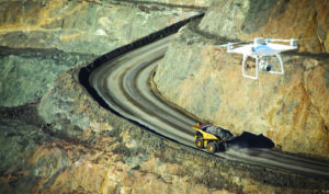
The next chapter of drones features better technology and more rules. (Photo: Propeller Aero)
The next chapter in drones in mining will be different from the first. The solutions are better, but the rules have multiplied
by jesse morton, technical writer
Autonomous drones are happening.
The news from the drone solutions space suggests the technology is proven. Drones can save a mine money on surveying.
Establishing that fact has taken time. Five years ago, the space had a distinctly Wild West feel. The players and the promises were many, and the rules were few.
Over the years, competition forced suppliers to focus, simplify and perfect. Mergers, acquisitions and vertical integration condensed the pool of competitors.
In 2018, new rules were added. Currently, to fly autonomous drones, most big U.S. miners need to file paperwork and get the greenlight from the Department of Transportation.
Some of the rules could expire in 2023, but until then, the drone space is a “strictly controlled, wannabe Wild West,” Stockpile Reports CEO David Boardman said.
“You have to deal with Federal Aviation Administration (FAA) regulations, and it is unclear how cost-effective and efficient the whole process is going to work for autonomous drones for a couple of years,” he said. “There are a couple companies working the edge of those regulatory constraints to try to make autonomous drones happen.”
Stockpile Reports is one such company. Recently, it partnered with American Robotics on a drone-in-a-box solution. The drone selected for development, the Scout System, can run 20 autonomous flights per day and can transmit data on stockpiles and other assets to support rapid decision making.
American Robotics was one of many suppliers that vied for the contract, but was the one that proved capable of delivering, Stockpile Reports said.
“What attracted us to American Robotics was their ability to navigate the regulatory environment and to make their unit work,” Boardman said.
The unit is a quadcopter that automatically takes off, executes a flight, snaps pics of stockpiles, and lands in a box that then closes up. “On autopilot, it pretty much has the same capabilities that a piloted drone would have,” Boardman said. “You identify the area that you want covered, it generates a flight plan, and then instead of a human pressing the button to say start, there will be a schedule created and it will fly itself.”
To identify the area to be covered, the user “pulls up Google Maps and clicks on the square on which you want it to fly,” he said. “What is different is there are takeoff procedures that are automated. The container has to open, the drone will rise, and then the drone will take off. The second difference is it comes back and lands itself. It drops down into its safe storage.”
It does it all while meeting the current regulatory requirements. Thus it eliminates the need for professional drone pilots and simplifies the process. “At the end of the day, for Stockpile Reports, we just need imagery as fast as we can get it as cheap as we can get it,” Boardman said.
Imagery is the primary fodder for the company’s flagship solution, an advanced online software system for quick, accurate stockpile quantification. The images can come from a stationary camera, a handheld device, airplanes or a drone.
Stockpile Reports selects the Scout System quadcopter by American Robotics for development for a drone-in-a-box solution. American Robotics won the contract because it delivers on its promises. (Photo: Stockpile Reports)
“We will take imagery from any of those platforms, do those inventory counts as fast and low-cost as possible, and then turn that into data that stands up to the tests of auditors and counts as a third-party count,” Boardman said. “This makes inventory simple and fast so customers can get back to high-value-creation jobs.”
Currently, initial trials are under way. “We are making sure that the units fly when and where they are supposed to fly and give the data needed,” Boardman said.
“Everything is going in the right direction, but we are not production-live yet,” he said. “We are still in this little burn-in period.”
Forward-leaning companies can begin to onboard with the realization that certain risks remain that have less to do with drones or data processing software. “If you want to be first, and be part of that wave, now is the time,” Boardman said. “But the reality is it is going to be a messy space for another couple of years.”
During that time, the FAA will likely revise the rules on autonomous drones for use at mines.
“To do an autonomous drone, it is not something you can just pull off and then ask for forgiveness,” Boardman said.
“You are putting something in place that is highly visible, that people know where it is, and the FAA is going to know about it,” he said. “The FAA, in my opinion, has a lot more influence and control of this chapter of drones than it did during the first chapter.”
Which has created a “nuanced” situation that nonetheless could prove to be an opportunity for the bold, he said. “It is happening,” he said. “Autonomous drones are happening. There has been a lot of talk and hype and a lot of slick videos, but it is starting to happen.”
And indeed, the FAA has, “in fact started supporting some autonomous operations,” Boardman said.
“There is not blanket authorization yet, but if people do the right paperwork and they have the right authorizations, you can start to deploy autonomous drones,” he said. “That is fantastic.”

Stockpile Reports’ flagship offering is an online analytics platform that gives quick and accurate stockpile volumes based on images. (Photo: Stockpile Reports)
Gold Standard Survey Accuracy
Fellow survivor of the first chapter, Propeller Aero, has gained traction in the mining industry by offering solutions that are relatively easy to use and that deliver heightened accuracy.
Recently, Propeller Aero reported it will support DJI’s M300 drone and Zenmuse P1 sensor for faster surveys. The drone features a refined propulsion system for greater range, and the sensor offers highly detailed images and more accurate survey data.
The drone can be used with Propeller PPK, a post-processing kinematic solution for large mines. The solution “is an automated, cloud-based, processing solution designed to transform site images collected from a drone into accurate and reliable drone survey data,” said John Frost, vice president, business development, Propeller Aero.
“At Propeller, we use the PPK workflow to process drone survey images within 24 hours to create highly accurate 3D maps of your worksite, fully vetted by our team of GIS experts,” he said. “This means there’s no downtime or complicated, manual processes for you or your team.”
The platform can serve as a centralized source of truth for faster dispute resolution, improved project oversight and reduced risk, Frost said. “The cloud-based platform can be accessed easily by any team member on site, plus stakeholders across the project.”
Drone surveys using Propeller PPK save time and money, he said. “Compared to traditional surveying techniques, drone surveying yields greater accuracy, in a fraction of the time,” he said.
At large mines, “what may have taken days to walk and manually gather data, takes minutes to fly a drone overhead,” he said. “The resulting data also acts as an important decision-making tool, reminding site planners not only the volume of their resources, but also where hazards are, where haul roads may be optimized, and how the medium and longer-term mine plans are progressing.”
A recent white paper by Propeller Aero showed PPK offers gold-standard aerial surveys with just one ground point. The report showed the offering was trialed in two flights and concluded it had a simple workflow that delivered heightened positioning and imagery accuracy.
For the trial, Propeller sought to test the claim that the solution “reliably provides photogrammatic models accurate to 3 cm from independent checkpoints across a given survey.”
Propeller Aero will support DJI’s M300 drone and Zenmuse P1 sensor for faster surveys. (Photo: Propeller Aero)
In the trial, a site that had been previously surveyed and geotagged was surveyed using the Propeller PPK solution.
First, a ground control point, called an AeroPoint, was set in a position that was then located on the public-domain grid. Additional AeroPoints were scattered around the site, including some that were placed outside the planned flightpath.
The drone was flown over the site twice. It used five batteries and 90 minutes. It made 15 unique AeroPoint captures. The drone’s SD card data were loaded to the Propeller Platform.
The platform interface walked the user through the steps of the AeroPoint survey, the PPK process was applied, and the resulting images and data were uploaded.
The data from the flights was processed using the known-point method. “This is where a single AeroPoint is placed on a marked position with known coordinates and that acts as a base station for the other AeroPoints,” Propeller reported.
The data from the first flight proved to give centimeter-level accuracy. Right-to-left distortion, or variance from the geotagged position, was no more than 1.2 cm, while the “height was 2.1 cm, both qualities well below the survey grade.”
Image quality was also assessed. The distortion was “at about 3 cm, with the average of absolute error values going below that at less than 2 cm,” Propeller reported. “These values are the best on the market and ideal for survey-grade accuracy.”
The data from the second flight produced similar numbers.
“All AeroPoints again reported internally consistent numbers as processed using the known-point method, with no individual point getting less than 1-cm accuracy, and most falling well better than that value in the height dimension,” Propeller said.
The image quality was the same as that of the first flight. “These values are the gold standard for survey accuracy,” Propeller reported.
The simple workflow of the PPK solution is unique to the current market, the company reported. “The drone and AeroPoints also solve the issue of working in private site coordinates because they have the ability to capture the data accurately and transform between coordinate systems easily by placing an AeroPoint on a local known point.”
Separately, a recent case study by Propeller Aero demonstrates how Nevada Gold Mines (NGM) uses
the PPK solution routinely for stockpile surveys.
The site, one of the biggest gold mines on the planet, spans 40 miles. Daily, the chief surveyor, and his team fly an armada of drones over the site, dotted with AeroPoints. Some days necessitate shorter flights, which give less accurate results.
Monthly, he oversees a longer flight to gather additional detail. “With that data, he’s able to go back and correct stockpile volumes for the days he knows the data accuracy might have been lacking,” Propeller Aero reported.
The data goes to the platform, where it is processed into a report for stockpiles. “Nevada Gold Mines’ metallurgical department has even built out an integration with their own tracking platform that allows them to import the report and automatically update their material trackers,” Propeller Aero reported.
The PPK solution is also used to inspect haul roads.
NGM selected the solution because it offered 3D modelling, a dynamic coordinate system, ease of use, and an easily accessible analytics platform. “With Propeller, Nevada Gold Mines saw many of the features they’d been waiting for someone to bring to fruition actualized,” the company reported.
“They have always been ahead of the curve on technology,” Frost said. Which delivers results.
“Our customers have greater insight into their worksites and operations that lead to better data-driven decisions, improved project oversight, enhanced accuracy and production quality, greater team alignment, and much more,” he said. “The beauty of Propeller is that we don’t just provide solutions, we listen to our customers and deliver solutions that meet their needs today and in the future.”

The M300 drone controller can be used for both piloted and largely automated flights. (Photo: Propeller Aero)
Easier-to-Use Surveying Solution
In the future, drones could be used for a wide range of applications. One company developing drone-based solutions for applications beyond aerial surveys and stockpile inventory management is Skycatch.
Skycatch recently reported one of the world’s biggest miners uses its High Precision Package (HPP) for highwall mapping. The system can generate 3D geology models for geologists and geotechnical engineers for use in planning pit shells, according to a case study from Skycatch.
“The unique highwall mapping capabilities of Skycatch allows the miner to deploy a less expensive, safer, faster and easier-to-use solution,” the supplier reported.
“HPP provides fully automated tools for drone-based capturing, processing, viewing and analysis of the highest resolution maps of its kind for high walls,” Skycatch said. Skycatch said the solution offers speedy accuracy, consistency and reliability.
“Skycatch has the tools today to provide high-quality, high-accuracy survey solutions for many different needs in mining, including highwall mining and tailings dam monitoring,” said Debbie Moon, vice president, marketing, Skycatch. “Skycatch is visionary and understands the need for solutions that automate and analyze to make mines more efficient and sustainable.”
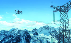
Skycatch’s drone-based scanner solution can replace terrestrial laser scans, which are expensive, the company reports. Above, a drone gathers data for tailings dam monitoring. (Photo: Skycatch)
HPP includes the drone mission planning app, Flight 1; a satellite systems base station and edge processor, Edge1; a photogrammetry processing engine, the Vision Engine; and a platform for analytics, the Data Hub.
The listed benefits include improvements in “safety, accuracy, reliability, consistency, faster time to data, and higher quality 3D output,” Moon said. “The Skycatch Highwall Scanning solution is replacing the need for terrestrial laser scans, which are expensive, cumbersome and require unsafe entry into the open pit to accurately capture the highwalls.”
It allows users “to map previously inaccessible areas, while staying out of harm’s way,” the company reported. “This also reduces any risk associated with vehicle and personnel collisions.”
The solution delivers cost savings. “A typical ground-based laser scanner can cost $100,000 to $250,000 or more,” Skycatch reported.
“Additionally, operating the system to obtain the data you need is cumbersome, time consuming and costly,” it said. “The portable Skycatch system is up to 10 times less expensive to purchase and significantly less expensive to operate.”
The ease and safety of use means it can be used more frequently, for more data. “Using HPP for more frequent data capture allows the site to make better decisions on an ongoing basis to be more productive and safer,” Skycatch said.
Skycatch launched in 2013. Initially, it was a pure-play drone supplier. As new laws were imposed on drone usage, “Skycatch pivoted to create automation tools like flight planning and automated processing of orthophotos, point clouds and 3D mesh, mainly in the construction and infrastructure world,” Moon said.
The supplier then partnered with Komatsu on drone solutions for construction sites. “This was when Edge1 was born,” Moon said.
“Edge1 enabled surveyors to capture the high-accuracy data without the need for placing ground control points, which required a lot of time in what could sometimes be unsafe conditions,” she said. “With Edge1, the capability to process the captured data in the field in less than 30 minutes was also introduced.”
Roughly 10,000 Komatsu construction customers worldwide use the Skycatch solution. “In the last three to four years, our solution began to be used for the mining industry where large mining companies began deploying it for general surveys,” Moon said.
“It enabled them to eliminate hours of survey time in open-pit mines, which often are very dangerous,” she said. “One company deployed the HPP for mining to eight sites and eliminated more than 12,000 pit interactions, improving safety significantly.”
The customer also used HPP to decrease the time to the high accuracy survey data, and “saved $6.6 million in survey costs alone,” Moon said. “Since then, Skycatch has been used in other important mining survey operations to improve safety and mining efficiencies including highwall mining and tailings dam monitoring.”
Currently, Skycatch is working on toe-and-crest detection, underground solutions and other high-value tools for the automated, sustainable mine of the future.
Designing Permissible Drones
A future where drones are even used underground to capture data for digital twins and automation solutions also approaches.
Recently, an interdisciplinary team of professors reported it is finalizing the design of an intrinsically safe drone propulsion system for underground coal. The development precedes the end of the first phase of a three-phase, three-year project that will result in a proof-of-concept by 2023.
The team of Ph.D. engineers from New Mexico Tech, the University of Texas, and the University of New Mexico is currently working closely with MSHA and the Alpha Foundation, which funded the project, to perfect the initial design to meet standards.
“We must conduct various tests to ensure that the designed system will not pose any additional safety hazards,” said Dr. Pedram Roghanchi, assistant professor, mineral engineering, New Mexico Tech. “When we successfully design the permissible propulsion system, our team will conduct optimization studies to improve the performance of the system.”
When the design is finalized, the drone will be fabricated and tested. Lastly, in phase three, the team will work with MSHA to test it.
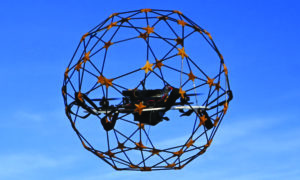
An interdisciplinary team of professors is finalizing the design for an intrinsically safe drone for use in hazardous areas underground. (Photo: Professor Mostafa Hassanalian, New Mexico Institute of Mining and Technology)
Designing a permissible drone platform with practical size and flight characteristics presents several challenges. The underground environment is defined by “confined space, reduced visibility and air velocity, increased dust concentration, and the lack of wireless communications,” Roghanchi said.
Additionally, the drone must meet MSHA’s standards and requirements for the intrinsic safety level for hazardous area classifications, said Dr. Mostafa Hassanalian, assistant professor, mechanical engineering, New Mexico Tech. “Ideally, an intrinsically safe machine cannot generate a spark, even through a static discharge,” he said. “The machine structure must be able to contain a blast and guarantee that no hot gas, hot parts, flame or spark are released.”
The expertise of team members includes mining engineering, mechanical engineering and electrical engineering. “Since 2018, we have been working on the applications of drones to improve the safety and productivity in mining working areas,” Hassanalian said.
“We previously designed an encased drone for underground mining applications,” he said. “Our initial focus was to improve the mechanical safety of drones, meaning to protect the workers against propellers and protect a drone from obstacles in underground mines.”
In 2019, the team won the grant from the Alpha Foundation to develop a drone for underground coal.
The team started by conducting a comprehensive review of the commercially available drones in underground mining, which included the Matrice 100, DJI M210, ELIOS 1 and ELIOS 2. “We also designed and developed a prototype of an encased drone platform for underground metal and nonmetal mining applications,” Hassanalian said.
“Our investigation indicated that a commercial intrinsically safe drone has yet to be developed,” he said. “For indoor drones, the main design focus has been on the mechanical safety of the platform, neglecting its intrinsic safety.”
To upgrade an indoor drone to be intrinsically safe could require armoring or hardening it, which adds bulk. That could negatively impact its ability to hover and maneuver. “The design of the propulsion system must be able to compensate for the gravitation forces,” Roghanchi said.
“Adding encapsulation toward an intrinsically safe drone using conventional methods would add substantial weight to the electrical components, including the battery and motors, which consequently will increase the total weight of the vehicle,” he said. “Fortunately, advances in materials have produced strong and lightweight materials for consideration.”

Joseph Martinez-Ponce, graduate student, New Mexico Tech, holds a prototype drone for Richard Cross, undergraduate student, New Mexico Tech, to view. The drone, for underground coal, is based on indoor drone technology, and is hardened to meet government requirements. (Photo: Professor Mostafa Hassanalian, New Mexico Institute of Mining and Technology)
Driving the project is a vision of how drones could improve safety and efficiency of underground operations. “Regular monitoring of underground mine conditions is essential in order to identify any potential risks before they reach hazardous levels,” Rognanchi said.
Most mines have numerous locations that are not easily accessible, such as unsupported and open stopes, abandoned areas, and contaminated areas, he said. “Monitoring of these areas requires a certified person to inspect the conditions before allowing any miners to enter the location.”
Further, there are areas underground that are simply unreachable, such as ore passes, ventilation raises and underground cavities. These too require inspections, Hassanalian said.
“Inspection of these locations is limited to remote monitoring as no miner is permitted to enter the area,” he said. “The small size and maneuverability of drones make them more suitable to be used in underground mines during monitoring of unreachable areas.”
Drones in underground coal could also be used for “surface roughness mapping, rock mass stability analysis, ventilation modeling, hazardous gas detection and leakage monitoring,” Rognanchi said.
“Another potential benefit of drones is the deployment of the device for conducting air quality tests, searching for trapped miners, and providing feedback of the mine condition in situations in which the rescue team is not able to enter the mine,” he said. “Drones will significantly improve the safety and productivity in underground coal mines.”